

The Little Wye's Mill History: A Self-Guided Walking Tour
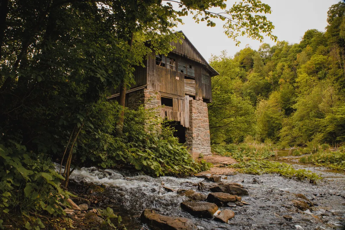
Walk upstream from the old bridge and you pass three centuries of work in ten minutes. The first thing you notice is the water. The second is the roofless wall at the bend that seems to hold up nothing at all — it is a mill's back wall, still doing its job, waiting for the river to come back. This route ties together the sites that have vanished, the structures that survived, and the paper trail that explains both. It runs about two miles and takes two unhurried hours. It works in either direction, though the stops below are described as a walk upstream.
Before You Set Out
Mill sites are rougher underfoot than the riverside path that leads to them. Expect nettles, broken masonry, slippery stone steps and the occasional sheet of glass in the grass. A dry leat in August can be a torrent in February, so check the river level after heavy rain before you commit to the lower section.
Bring:
- Boots with grip, not trainers with smooth soles
- A paper map, folded in a pocket — signal drops in the valley
- A torch, even at midday, for peering into wheel pits
- Water and a snack; there is nothing open on the middle stretch
- A phone charged enough to get you home if you turn an ankle
Much of the route is on public footpaths, but several of the most interesting walls stand on private land. Look for stiles and waymarks, keep to the line of the path, and if a gate is closed, close it again behind you. If you want to step off the right of way for a closer look, ask at the nearest house first. It is a two-minute conversation that saves an afternoon of being shouted at.
How to Read a Mill Site
The trick is knowing what you are looking at before you get there. Almost every watermill leaves the same handful of clues, and once you can spot two of them you will start finding mills on walks where you never noticed one before.
- The fall. Mills need height. The steepest drop in a river — a riffle, a small weir, a sudden change in the bank — is usually where a wheel once turned.
- The flat channel. A headrace or leat runs almost level, above and beside the natural river, with straight stone sides and unnaturally tidy edges. Rivers wander; leats do not.
- The wheel pit. A rectangular slot cut into masonry, often with a brick arch, iron brackets or a curved wear mark on the stone floor where the wheel rim ran.
- The tailrace. Water has to leave. Look downstream for a straight cut through the bank returning water to the river, sometimes with a silted-up apron of stone.
- Millstones. Dressed circular stones with a square hole in the centre turn up as steps, gateposts and paving. The square hole took the iron cross that carried the stone.
- The names. Mill Lane, Mill Cottage, Weir Field. Old field names on estate and tithe maps often outlast the building itself.
The Route, Stop by Stop
Stop 1 — The Weir and the Head Sluice
Start at the footbridge and look upstream. The low stone weir raises the water just enough to push it sideways into the leat on the left bank. On the right-hand end you can usually find the slots where timber boards, or paddles, were dropped in to control the flow — a miller's throttle. Note how little water the leat carries now. In working days the whole river could be sent down it, leaving the natural channel nearly dry.
Stop 2 — The Wheel Pit and the Wall at the Bend
Follow the leat for four hundred yards until it widens into a shallow, silted basin. This was the millpond, holding a head of water for the mornings when the river ran low. The wall at the bend is the gable end of the mill itself; the rest came down when the roof went. Peer over the edge, carefully, and you will see the wheel pit below, partly filled with rubble. Do not climb in. Masonry like this shifts, and the sides are deeper than they look.
Stop 3 — The Miller's House
The white house with the shallow-pitched roof and the big chimney stands slightly uphill of the mill, which is typical: the miller wanted to be above the damp. Look for blocked openings in the garden wall that once carried a drive shaft or a covered walkway to the mill. A stone trough by the gate is very likely a reused millstone or part of one.
Stop 4 — The Tailrace and the Track
Downstream of the wall, a straight channel cuts back into the river. Beside it, a hollow way runs up to the lane — the track the carts used for grain in and flour out. Its width tells you the scale of the trade: a single cart could pass, but not two. Halfway up, on the left, a low platform of brick rubble marks the loading bay.
Stop 5 — Where the Second Mill Stood
The final stretch crosses a hummocky field that has never been ploughed flat. Patches of nettles, brick fragments and a single stone sill in the grass are all that remain of a smaller mill that worked here first. Nothing dramatic. But once you know the pattern, the field stops looking empty.
Where the Stories Are Kept
A walk becomes a history when you check it against documents, and most of what you need is free to consult. The county record office and the local studies library hold tithe maps and apportionments from the 1840s for most parishes, naming owners, occupiers and what every field was used for. Census returns from 1841 onwards list occupations house by house, so you can watch a miller appear, take on a journeyman, and eventually disappear from the street. Older local newspapers carried sale particulars that describe machinery in useful detail. Trade directories list the same names year after year, which is how you date a change of use from corn to paper, bone, sawing or, finally, electricity.
Take photographs of what you find and note the grid reference. If you spot something unusual — a carved stone, a maker's plate, an iron casting with letters on it — send the location and a photo to the records office rather than moving it. They will know whether it is already recorded or genuinely new.
Practical Notes for the Day
Allow two hours at an easy pace, or three if you stop to sketch. The best light for reading masonry is a low sun, so late afternoon in winter shows more than noon in June. Wear long trousers through the nettle section beyond Stop 4, and keep dogs on a lead near the weir and the farm at the halfway point.
Rights of way change, and the definitive map held by the local authority is the only version that counts. If a path is blocked or a stile has gone, report it to the council's rights of way team rather than finding your own way around. And if you are walking alone, tell someone your route and your rough return time.
Photo: Dominik Gawlik / Pexels